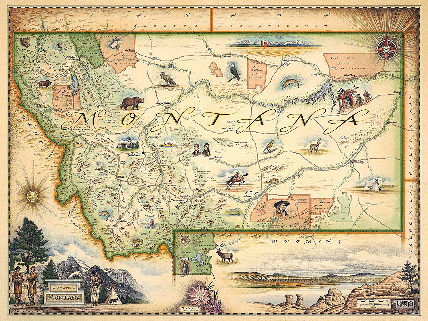
Unique hand-illustrated Montana state map. The Montana State Map is 24″ wide x 18″ tall.
The absolute best hand-drawn illustrated map available from brothers Chris and Greg Robitaille and their company, Xplorer Maps. Chris is the master illustrator and Greg runs the day to day operation. Xplorer Maps is located just north of Yellowstone Media and Yellowstone National Park in the beautiful town of Missoula, Montana. Their very first Xplorer Map is the Montana State Map and we are proud to offer it through our Yellowstone Media Store.