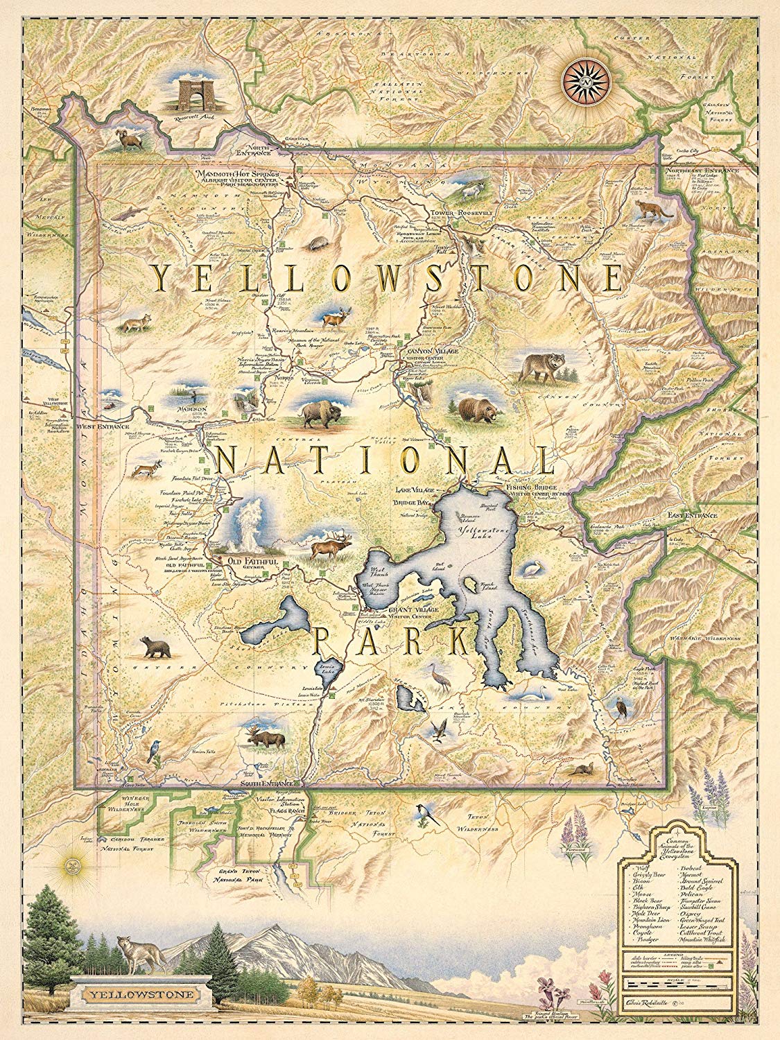
Description
Xplorer Maps chose the world’s first National Park – Yellowstone, to debut the ever-growing line of National Park map illustrations. Released in March 2010, the Yellowstone National Park map highlights the unique geothermal features of the region (including Old Faithful), outlines the integral Native American history, captures the story of the park’s official designation and details the region’s most studied fauna.
The Yellowstone National Park Map is 18″ wide and 24″ tall.
Xplorer Maps creates the world’s finest hand-drawn and hand-lettered illustrations of national parks and other significant historical sites and destinations throughout the world. Every line, letter, and icon is unique, custom and original to each new map we render. Originally designed to pay homage to the early cartographers, these high quality and exceptionally detailed custom maps are rendered by Chris Robitaille (Xplorer Maps artist and co-owner) using an antique, old-world style.
The maps make excellent gifts and are attractive as framed art for home, office, resort or hotel decor.
Setting Xplorer maps apart from any other “map product” on the market, these fine-art illustrations have been approved by National Park Service specialists and their respective non-profit partners on the basis of educational merit, interpretive value, cultural relevance, and historical and geographic accuracy. There are simply no other maps that can compare anywhere!
Xplorer Maps began because two brothers were passionate about making a connection between beautiful, unique artwork and the Montana mystique. Artist and co-founder Chris Robitaille began creating similar antique-style maps in the late 1990s while living in Kenya. Over the past 15 years, Chris and his brother, Greg (Xplorer Maps president and co-founder) have continually refined their vision of using these incredible “story maps” with the opportunity to help local communities raise awareness for conservation and wildlife around the world.
The brothers – a talented globe-trotting artist and an entrepreneurial Montana geography buff – wanted to take their vision to help convey the message about the importance of bringing together art, history, culture, education, and conservation. It is through these beautifully illustrated story maps that Xplorer Maps hopes to provide people with unique memories of wherever their journeys have taken them and help raise awareness for the special places in which we all live or visit.—Xplorer Maps